125 MHP - Moose Hill Parkway - Sharon MA

Land Overview

Welcome To 125 MHP
Prologue
Searching For The Ideal
Original Purpose & Equestrian Design
Accessibility & Entertainment
Location... Location... Location!
Living On Moose Hill... Includes Trail Maps
Exclusively, A Special Private Island Unto Itself
Plot Plan & Land Measurements
Land Overview
Autumn Splendor
Winter Spectacular
Out Buildings Overview
House Overview
Interior Overview
Living / Dining Room Areas
Office / Casual Dining
Kitchen
Master Bedroom
Second Bedroom / Den
Main Full Bath
Half Bath
To Lower Level
Family Room / Conference
Third / Guest Bedroom
Lower Full Bath
Wash / Prep - Ent Kitchen / Craft Room
Last, But Not Least... The Root - Wine Cellar / Office
Wildlife
Natural Beauty In The Spring

.

125mhp_knollbanner_knollfrontofhouse_x200dpi_x560_sl.jpg

The Topography of 125 MHP

Level Land / Rolling Hills / Pine Knolls


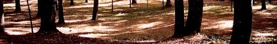
The unique topography of 125 from the street to the house was created with the building of the road.  In leveling a dip in the terrain, the town created a knoll, which over the years of selective pruning is now basically a pine knoll which "frames" the house when viewed from the street.  As the knoll is flat, a cantering circle was cleared, sifted, and graded to accommodate a little horsing around. 

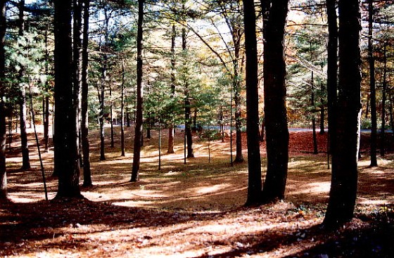
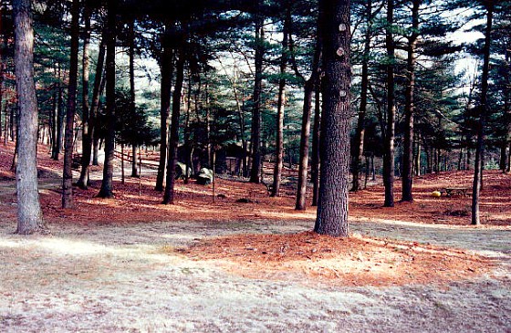
Beyond the knoll, where the house is built, the land on the right side of the property is essential flat.  It is on this land that the shed and barn are placed.

To the left side of the property one finds the land gently rising.  From the level part, this seems unremarkable.  However, as one can see from the photos taken atop this little hill, the perspective on the propertry changes dramatically.  This area is a favorite spot to hoist a "cool one." 

Finally, rather than place smaller but expandable photos on this page, large photos are being presented to immediately provide a scale of the property.   

For Dial-ups, This May Mean A Slow Loading Page

125mhp_drivewaytohouse_200dpi_x560_sl.jpg
From the foot of the drive, house set back approximately 250' - pine knoll to the right

125mhp_housefromstreet-200dpi_x560_sl.jpg
View from the street of house looking through pine knoll

125mhp_knollfrontofhouse_x200dpi_x560_sl.jpg
View of pine knoll and cantering oval from upper driveway

125mhp_shedbarnfromdeck_200dpi_x560_sl_cc.jpg
View from main deck of shed, barn, track and corrals

125mhp_housefrombackleft_x560.jpg
Taken from land between house and barn: House / deck showing the foot of the hill at the right

125mhp_housefromhill_200dpi_x560_sl.jpg
Taken from the hill: Rear of garage / house showing access road, right of garage, to out buildings

125mhp_barnshedcorals_x560.jpg
Taken from the hill: Far left corrals, center is barn, to its right is the shed

125mhp_housefrombarn_x560_sl.jpg
Looking from barn to house: Barn entrance to left, shed on left beyond, house in the distance

125mhp_track_fireroad_rearproperty_x200dpi_x560p_sl.jpg
View from same spot at barn entrance of track and rear property line in the far distance.

125mhp_back_pristina_18_bold_2x6x4.jpg
125mhp_top_pristine_bold_18_2x6x4_clean.jpg
125mhp_wooden_compass_rose.jpg
125mhp_home_pristine_bold_18_2x6x4_clean.jpg
125mhp_next_pristina_18_bold_2x6x4.jpg